CORONA & BOWTIE ARCH TRAIL
This hike was recommended to me by a fellow dog mama so it was obviously a priority in the Moab area.
Beginning in a spacious, sandy parking lot and winding it's way through Bootlegger Canyon this two-and-some-change mile hike is the perfect for legs that have been shoved into cramped foot wells of the sedan. You will cross one set of train tracks and I urge you to take note of the fascinating way the trains path was cut out of the monstrous rock. I also urge you to keep track of your footing while doings so as there are many unforgiving plants in this area that would love to leave their marks on your ankles.
You are immediately rewarded with spectacular views of the slickrock that dominates Southern Utah. Sure sure, the arches are the big draw of the area but to be perfectly honest, and kind of opinionated, if you came here with the sole purpose of hunting arches you're missing a lot. Each step I took I felt a different sensation, sometimes I would feel my feet sink into the sand, sometimes the sole of my shoe would slip right off the side of a boulder, and sometimes I would take a cactus needle to the shin. I so enjoyed watching the red sand, remnants of the behemoth sandstone structures that have been pulverized over time, engulf my boots in an eerie cloud of dust with each step. Incredible towers of sandstone towers rocketing toward the sky as if they felt they had no business being on this earth. There was so much to take in it was downright dizzying.
On this hike you will find that following the cairns will guide you accurately, except when you reach the plot of land with a cairn graveyard off the side of the trail. Bowtie and Corona Arch come into view at the same time but should both be appreciated close up and separately. Bowtie arch juts from the surrounding rock wall for an open-roof cave of sorts, creating a portal through which you can gaze to the heavens. Corona Arch is a more traditional upside down parabola. Alltrails noted that this trail is moderately trafficked which I found to be accurate, although, unlike in the National Parks such as Arches, you won't have as much trouble finding a clear moment to take photos without dozens of bystanders tying their shoes and adjusting their packs in your way.
I love open trails because I can keep an eye on my off leash dogs as they fluff around, but this did lend to more sun exposure than I would be able to tolerate on a mid Summer day. Should you choose to brave this hike during a scorcher, the muddy waters of the Colorado River are just across the street of the parking lot and would make for a nice post exertion ice bath. There are also several campsites* along the river, I have my eye on site #5 when I return with a tent.
So that's that, an easy out and back with no shortage of photo ops and wonders to behold with the option of taking a dip after your hike. Get out, stretch your legs, and enjoy!
*Information on camping at Gold Bar can be found here:
https://www.recreation.gov/recreationalAreaDetails.do?contractCode=NRSO&facilityId=256948&agencyCode=70901


Bowtie Arch can be seen behind the big fluffy pup.
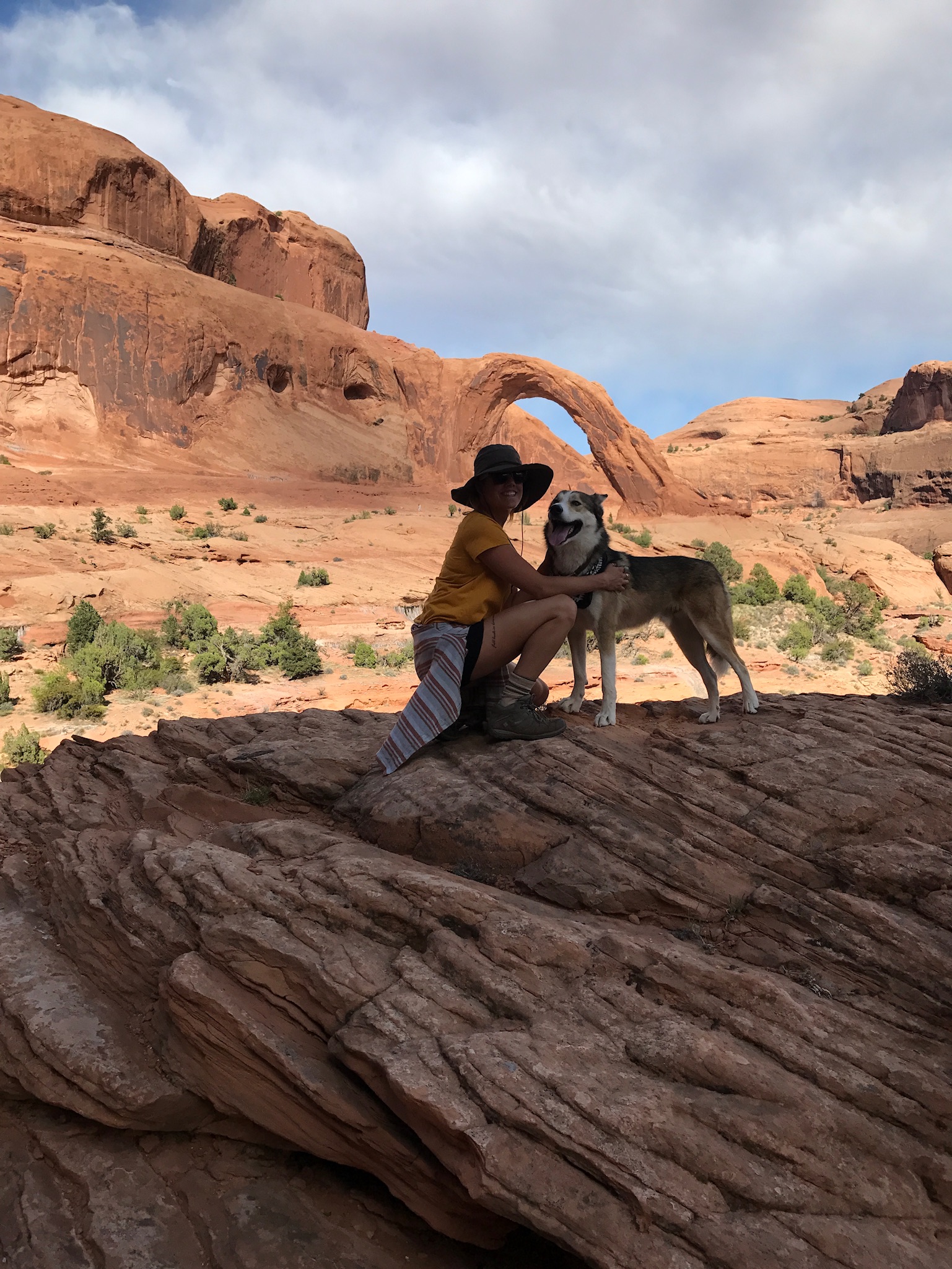
After you walk under Bowtie Arch the trail proceeds and concludes at Corona Arch, pictured behind me here.

CAIRN GRAVEYARD. The path is well marked with Cairns, but it looks like some hikers got carried away with Cairns in a large flat area along the trail.
